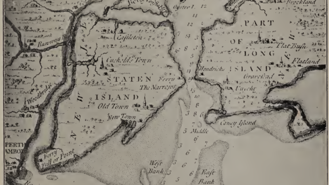
One of the most informative books to be written about Staten Island’s early history is Staten Island and Its People, published in 1930 by Charles W. Leng and William T. Davis. They took 4 years to research and write it. It consists of two volumes — the first one is over 700 pages long and the second volume is over 600 pages long.
In this article we take a tour through Volume I — from glaciers and Lenape villages to ferries, Wild West shows and the Great War.
1. An Island Shaped by Ice and Water
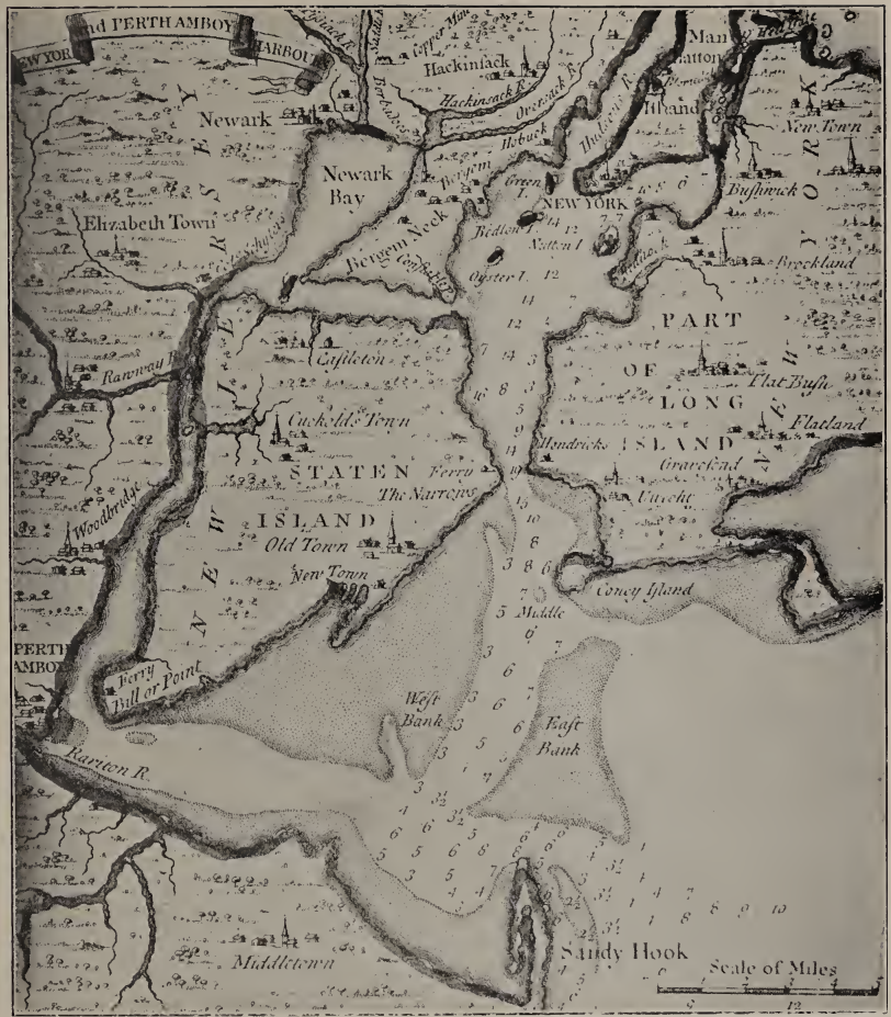
Volume I of Staten Island and Its People, published in 1930 by Charles W. Leng and William T. Davis, covers the island from the ice age to the 1920s in fourteen chapters, and it starts with the ground underfoot. Leng and Davis argue that geography governed settlement: steep hills, tidal marshes, fertile soils and separating waterways helped determine where people lived and how they traveled.
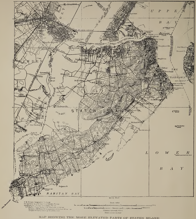
The authors describe an island 13.9 miles long, 7.3 miles across at its widest part, with 35 miles of waterfront and about one-seventh of it is salt marsh. It is bordered by New York Bay, the Kill van Kull, the Arthur Kill and the Lower Bay. They explain that the Dutch word “kill” means creek, a reminder that even the map preserves the language of early European settlers.
The geography chapter is also a tour of place names. The Dutch called Todt Hill Yserberg, or Iron Hill, for the ore found there, and the authors weigh three theories for the later name, favoring “an early use of the hill as a burying place.” Another entry credits the view from Howard Avenue on Grymes’ Hill with inspiring the “oft-quoted sentence” that “God might have made a more beautiful spot, but never did.” The brooks and springs get the same attention, and the Watering Place at Tompkinsville is called “perhaps the first natural feature of Staten Island used by Europeans.”
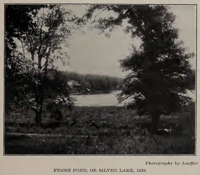
Fresh Pond, or Silver Lake, 1896. Photograph by Loeffler.
Its heights were equally distinctive. Grymes Hill, Emerson Hill and Todt Hill belonged to a serpentine ridge, while glacial debris formed another chain of hills. The book calls Ocean Terrace, at 413 feet, the island’s greatest elevation, and treats the vistas from the high ground as a defining local attraction.
Below those heights ran an astonishing network of brooks, ponds and salt meadows. Silver Lake, before becoming a reservoir, drew boaters and skaters; the authors relish the story that its supposedly bottomless waters proved to be only about eighteen feet deep. Such details make their geography feel inhabited rather than abstract.
Geology also became business. Iron ore from the hills supplied furnaces and paint manufacture, while clay deposits sustained brickmaking. In the authors’ account, the landscape was never merely a backdrop: it provided resources, obstacles and opportunities that shaped the island’s economy.
2. The Wild Island the Authors Wanted to Save
Leng and Davis were naturalists as well as historians, and their affection for Staten Island’s woodlands runs through the opening chapters. They describe flowers, insects, birds, ponds and swamps with an attention rarely found in conventional civic histories.
The authors estimated the island’s species at “not less than 10,000,” yet much had gone: “We no longer have the herds of wild deer or the flocks of wild turkeys that helped the Indian larder.” Even the orchids have thinned out: “Instead of twenty-three species of terrestrial orchids we are glad to count three or four as still extant.” The oyster beds and the shad fell to pollution, and goats, swine, European sparrows and starlings have moved into the empty places.
One particularly striking passage recalls how naturalists treasured the rare beetles of Silver Lake and the varied plants of the marshes. The authors also note that portions of the island remained difficult to reach by land, leaving secluded habitats surprisingly close to New York City.
Henry David Thoreau
The most vivid passage is a letter from a famous visitor. On July 7, 1843, Henry D. Thoreau wrote to his mother about the seventeen-year locusts: “The air here is filled with their din.” He transcribed their call as “Phar-r-r-aoh, Phar-r-r-aoh,” and noted that the insects would be back in 1860. The authors, who were both working naturalists, clearly enjoyed the detail, and it fits a book written by men who had been collecting specimens on the island since the 1880s.
By the 1920s, however, the authors feared that roads, construction, fires and careless visitors were destroying what made the island unusual. They reprint the Staten Island Bird Club’s plea that proposed parks retain substantial stretches of natural woodland instead of converting everything into manicured grounds.
The Bird Club’s argument is remarkably direct: “Reverence is the commencement of many virtues, and we should be taught reverence for Nature.” It gives this historical volume an unexpected conservationist voice, reminding readers that debates over development and open space were already vigorous a century ago.
3. The Indians on Staten Island
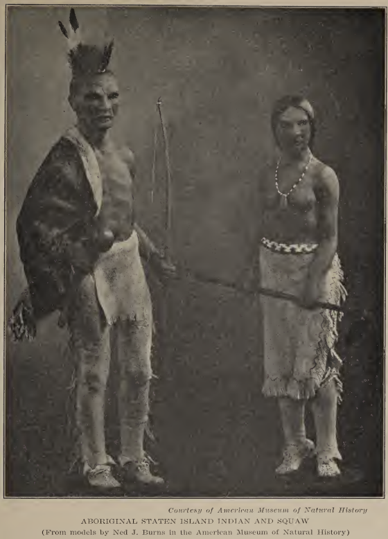
The book next turns to the island’s native Indian population — which it refers to as original aboriginal inhabitants — describing their connections to the wider Algonquian-speaking, Lenni-Lenape world and discussing archaeological discoveries, tools, food gathering and settlement sites.
In particular, the authors talk about why the Indians were drawn to the island — for fishing, shellfish gathering, hunting and the waterways that connected the island to neighboring territories.
They go into extensive detail on the Indians — how they built their homes, how they built canoes, what tools they used to hunt with, what kind of art they created, and so forth. It is worth a read directly in the book — pages 71 to 80. The link to the book itself is here and also at the bottom of this article.
Here is a description of Indians from the book: “Coming now to an account of their personal appearance and dress, we have the testimony of De Vries (1665) “The Indians about here are tolerably stout, have black hair, with a long lock, which they let hang on one side of the head. The hair is shorn at the top like a cock’s comb. . . . Some of the women are very well featured, having long countenances. Their hair hangs loose from their head; they are very foul and dirty.” Skinner adds that he was informed by an aged Indian that the hair was burned or singed off the head by means of hot stones. Another account reads, “The natives are generally well limbed, slender around the waist,
broad shouldered, all with black hair and brown eyes; they are very nimble and swift of pace, well adapted to travel on foot and to carry heavy burdens.” Dankers and Sluyter in 1679, met some Indians upon the beach with a canoe. The impression made upon them was “dull of comprehension, slow of speech, but otherwise bold of person and red of skin …. they have thick lips and thick noses, but not fallen in like the negroes, heavy eyebrows or eyelids, brown or black eyes, and all of them black hair.”
More: “Before the coming of the white men, they were dressed entirely in the skins of the animals they killed for food, deer and beaver especially. They speedily adopted, however, the woven material they obtained from the Dutch so that the earliest descriptions give little information of their primitive dress.”
The authors also examine the Algonquian language and its habit of packing whole sentences into single words they call polysynthesis, “a much putting together.” They list the Native names for the island: Eghquaons, which became Aquehonga, meaning “high sandy banks”; Motanucke, “land of periwinkles”; and perhaps Seawanhacky, “place of seawan or wampum,” a name that belonged to western Long Island but may also have been applied here.
4. Hudson, Dutch Ambitions, & English Rule
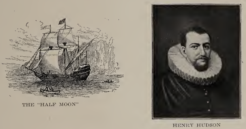
The European story begins on September 3, 1609, when Henry Hudson’s Half Moon anchored in the lower bay. The authors reprint the journal of the mate, Robert Juet, who records that the crew sent a boat ashore with a net and “caught ten great mullets, of a foot and a half long a piece.” Local people came aboard “very glad of our coming,” and “brought green tobacco, and gave us of it for knives and beads.”
The Dutch then used the island more than they settled it. Vanderdonck wrote that “The outward bound vessels usually stop at the Watering Place under Staten Island,” and the authors believe that spring near Tompkinsville was in use by about this time. Patroon schemes followed, first De Vries and then Cornelis Melyn, whose colony was a second unsuccessful attempt.
Battles with the Indians: The Peach War
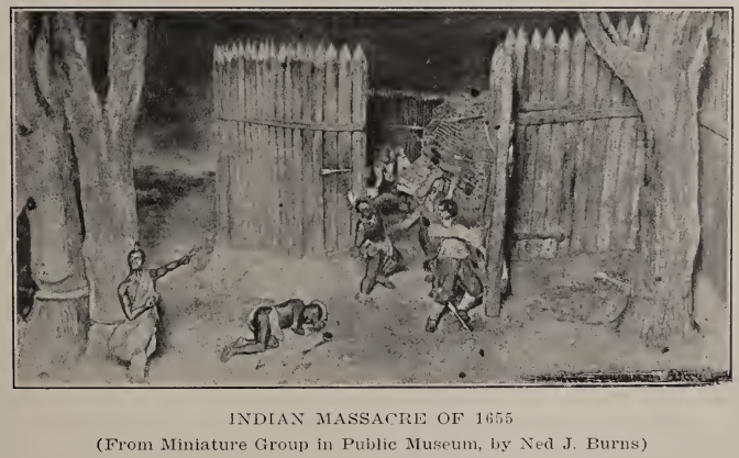
The details of some battles with the Indians are discussed in detail. A battle that became known as the Peach War broke out in 1855 when “a squaw was shot on Manhattan Island for stealing a peach. Her death was avenged by an attack on Manhattan September 15, 1655, which was repulsed. Early on the following morning the Indians attacked the settlement on Staten Island, which being unprotected by soldiers, was nearly annihilated.”
As Cornelis Melyn is quoted as saying (on page 81) after the Manhattan Island attacks: “I then immediately departed for the Staten Island to see whether I could save my people, houses and goods from the savages; but in vain; for a few days later the savages arrived there in great numbers and commenced to attack our people, to set fire to the houses, stacks, barns mostly full of grain, so that the people were obliged to seek safety in my house which they (the savages) also succeeded in setting afire.”
The book is happy to correct a legend. Pierre Billiou, a founding settler, was long described as a Waldensian from the Pays de Vaud “by an error in translating the Dutch word Walslant.” The authors insist “He really came from Artois in French Flanders,” and they devote a short section to what they call the Waldensian myth.
After the English takeover in 1664, government, landholding and everyday life gradually took new forms. Yet Dutch names and family connections survived, producing a layered local culture rather than a clean break between eras.
The island’s farms, roads, ferries and small settlements grew within a world of uneven communications. Water made the island accessible to boats but separated it from courts, markets and officials across the harbor; the same geographic advantage could become an administrative inconvenience.
What emerges is a colonial community built from overlapping influences: Dutch and English authority, and settlers of varied backgrounds. The book’s close attention to old names and property records makes those changes visible in the landscape itself.
5. Colonial Staten Island: a Bargain in Wampum & Guns
The English took over in 1664, and on April 13, 1670, Governor Lovelace bought the island from the Indians, “taking title by turf and twig” as well as by deed. The payment is itemized in the book: “400 fathoms Wampum,” kettles, coats, shirts, axes, knives, “20 guns; a Firkin of powder,” and sixty bars of lead. The authors note, with some wit, that boys and girls as well as men signed the deed, so that the sellers would not forget the transaction.
Governor Dongan arrived on August 25, 1683, and on November 1 the County of Richmond was created, named for the Yorkshire dukedom. A few years later a grant to John Palmer was confirmed as “The Lordshippe or manner of Cassiltowne,” the start of today’s Castleton. Life was rural and not entirely admirable. By 1698 the population “had grown to a population of 727, of whom 10% were slaves,” although the authors also note Andros’s 1680 order “declaring all Indians free and not slaves.” Schools came through the church, with the Society for the Propagation of the Gospel paying two schoolmasters from 1711 onward.
6. The Revolution at Staten Island’s Doorstep
The Revolutionary War transformed Staten Island from a rural colony into an occupied strategic position. British forces landed there in 1776, and the island became a base for military movements around New York Harbor.
The authors follow the experiences of Loyalists and Patriots, the building of defenses, military regulations and the strains imposed on civilians. The island’s position near the Narrows gave it military importance far beyond its population.
The Peace Conference at the Billopp House
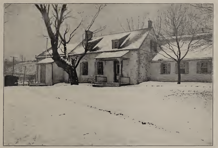
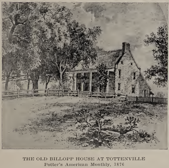
The Revolution chapter centers on one remarkable day. After the Declaration of Independence, Lord Howe arrived with hopes of reconciliation and issued a declaration on July 14 “given at Staten Island.” On September 11, 1776, Benjamin Franklin, John Adams and Edward Rutledge crossed over to meet him at the Billopp House. The setting was elegant. John Adams recalled that Howe “had prepared a large handsome room, by spreading a carpet of moss and green sprigs” from the neighborhood, and that the delegates were fed “good claret, good bread, cold ham, tongues, and mutton.”
The hospitality did not change the outcome, since Franklin replied that a return to British domination was impossible. The house itself had a rougher later history. Colonel Billopp was captured by raiders twice, in June 1778 and again in June 1779. The first time he was caught returning from a ball, “fatigued and half asleep”; the second, he was seized from his bed at night, and he never lived in the exposed house again.
The authors also pursue smaller Revolutionary War stories of raids, secret intelligence, personal loyalties and disrupted homes. Their account makes clear that war was not simply a sequence of distant battles: on Staten Island, military occupation entered roads, farms and family life.
When peace came in 1783, the island had to return to civil routines after years of disruption. That transition is an important hinge in the book, separating colonial and wartime Staten Island from the rural society that developed in the new republic.
7. Farms, Villages, & The Vanderbilt’s
After the war the island turned to boats and real estate. For decades after independence, Staten Island retained a strongly rural character. Farms, orchards, local roads and scattered hamlets shaped everyday experience, while nearby New York City steadily increased its influence.
The authors’ chapter on old-time rural Staten Island evokes a world in which neighbors knew the farms and families along the roads. It also records the slow appearance of new services, institutions and routes connecting formerly separate communities.
Between 1843 and 1866, village growth accelerated. Places along the north and east shores developed more defined identities, and improved transportation encouraged settlement by people whose work or business connected them to the city.
This was not a uniform transformation. Some neighborhoods acquired a suburban character while large stretches remained farmland, woodland or marsh. The island’s familiar contrast between dense shore communities and open interior country was already taking shape.
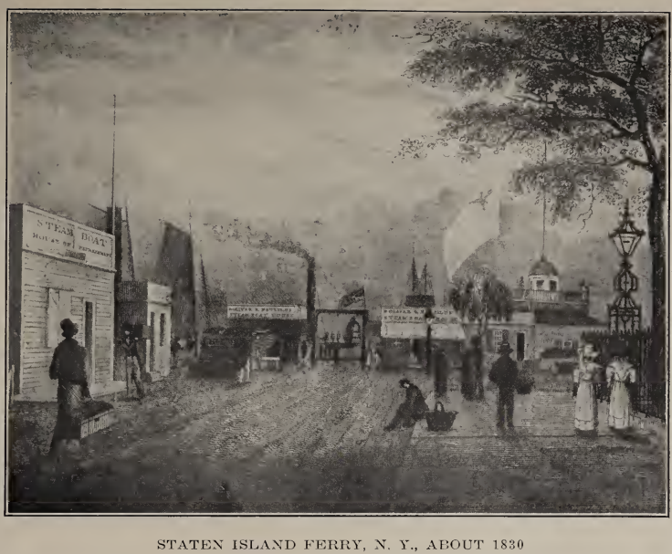
The book records that in 1812 Cornelius Vanderbilt, later the Commodore, was “the eighteen-year old commander of the ‘Dread,’ the largest and fastest periagua in the bay.” In 1833 Minthorne Tompkins and William J. Staples bought land from Vanderbilt and his siblings, and the name Stapleton was given to the village that grew there. Writers were drawn to the new villages too, and the chapter notes that the “Snuggery” sheltered both Ralph Waldo Emerson and Henry David Thoreau.
The violence of the 1850s and 1860s is told through documents. The Quarantine at Tompkinsville had caused deaths in “that unfortunate village,” and on September 1, 1858, a mob burned it, “utterly demolished the whole establishment,” after dragging patients from their beds.
8. The Civil War & a Changing Society
The Civil War chapter broadens the story beyond battlefields by introducing Staten Islanders active in abolitionist causes. Among the figures discussed are Sydney Howard Gay and Francis George Shaw, whose lives connect the island to national debates over slavery and emancipation.
The book recalls antislavery meetings, lectures and fairs, and describes how abolitionists organized support through persistent local networks. Its account also includes memories of the Underground Railroad, placing moral and political conflict within the setting of private homes.
Staten Island also experienced the war through military service, public opinion and the demands made upon families. These stories complicate any image of the island as merely a peaceful retreat across the harbor.
By following individual activists alongside broader events, Leng and Davis show how national history was lived locally. The Civil War years become a story of convictions, institutions and people, not just dates and campaigns.
In July 1863 the draft riots reached the island, with crowds shouting “No Draft,” a car house burned at Vanderbilt Landing, and attacks on Black residents on McKeon Street. The county later paid $17,207.99 in damages.
9. Suburbia: A Casino and Buffalo Bill
From 1866 to 1898, the book portrays Staten Island becoming more unmistakably suburban. New residential communities, transportation connections and public improvements drew it more tightly into the metropolitan region.
The decisive governmental change arrived in 1898, when Staten Island joined the consolidated City of New York as the Borough of Richmond. The authors trace the ensuing administrations and civic projects, including Borough Hall, Curtis High School, ferry improvements and public-health facilities.
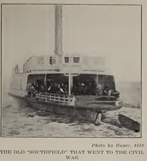
The authors both grew up on the “old” Staten Island, and the suburban chapter is partly a memoir with a tone of regret. The population was only 38,991 in 1880, but once Erastus Wiman rose to prominence in 1884, “important changes came quickly.” The Staten Island Amusement Company promoted a huge casino at St. George that cost $35,000 and could seat “over 5,000 persons.” At Erastina, Buffalo Bill’s Wild West show drew crowds to a grandstand for “some twelve thousand persons,” brought in by trains of “cattle-cars,” as they were locally known.
Consolidation with Greater New York in 1898 produced a borough with a new civic apparatus. The first sod for the Borough Hall at St. George was turned on December 15, 1903, and the cornerstone was laid on May 21, 1904, with Mayor George B. McClellan and Chauncey M. Depew taking part. Some milestones were more practical, such as the West New Brighton crematory opened in 1899 and replaced in 1908, and the draining of the salt meadows, which cut the mosquito population.
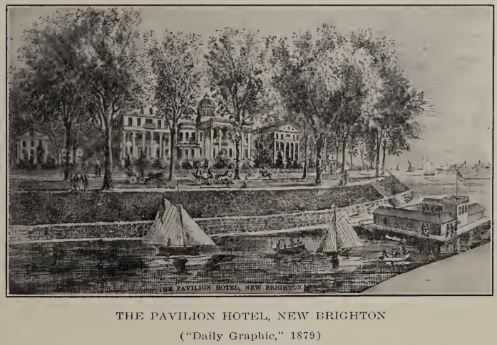
Consolidation did not erase older village identities. Indeed, the book carefully catalogs place names and nicknames, suggesting that borough government and neighborhood memory existed side by side.
10. The Great War
The First World War brought another new chapter. The authors describe Staten Island’s participation in a conflict fought overseas but felt at home through mobilization, public service and community sacrifice. Remember this book was published in 1930, before anyone was numbering world wars — so World War 1 is simply called the World War.
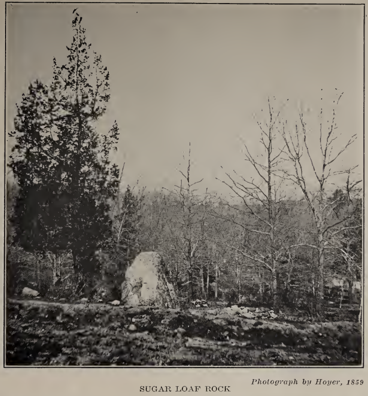
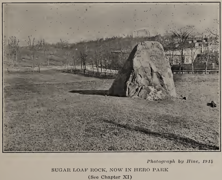
The World War chapter records the island’s response in lists and figures, including over 500 early volunteers and a Red Cross chapter that reached 18,000 members. Its monument is Hero Park, dedicated on May 31, 1920, in which “a spruce tree and a tablet is dedicated to each of those who gave his life.” At the center stands a boulder “deposited where it stands in glacial time,” which ties the book’s final chapters back to its first.
11. Politics, Church, & Schools
Politics and religion get long chapters. The political history shows an island of closely fought contests where “neither Republican Whigs nor Democrats could ever feel sure of the result until the votes were counted.” In 1856, for example, Buchanan carried 1,550 votes to Fillmore’s 947 and Fremont’s 736.
Among the churches, the Moravians consecrated their first church on December 7, 1763, and the chapter links their arrival to a ship’s captain who carried Bishop Spangenberg and to early converts from the Vanderbilt family.
Houses of worship also served as landmarks in a landscape undergoing repeated transformation.
The book ends with education. The account of schools and teachers reveals another essential part of the island’s growth. Education developed alongside population, local government and the increasing expectations of families seeking opportunities for their children.
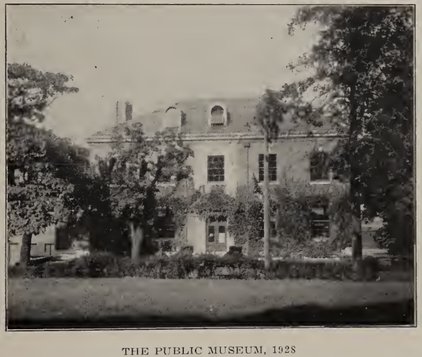
The authors also mention the institution they helped create: The Natural Science Association, which was organized on November 12, 1881, when “fourteen men, most of whom were young” gathered at William Davis’s home, with Charles Leng as recording secretary and Davis as curator. It grew into the Institute of Arts and Sciences, about which the authors write that “Few communities of the size of Staten Island can boast of better facilities for education by museum exhibits.”
In their preface, Leng and Davis say they hoped to “assemble accurately the history of Staten Island from its earliest period to the present time.” They acknowledge that they had not achieved perfection. That modest qualification is worth remembering: this is a rich 1930 record of the island’s remembered past, and also a historical artifact revealing what its authors thought most important to preserve.
Remember — this was all Volume I. There is also a 700-page Volume II that we cover in another article.
The Book Itself — Available Here
Click the link to read volume I of the book itself:
Be the first to comment